Coastal path from Roses to Cala Montjoi
Hiking lovers and those who love bucolic walks cannot miss this must-see footpath by the sea with privileged views of the Mediterranean Sea. The origin of the term camí de ronda (literally, “round footpath”) comes from the rounds or guards that the patrols of the Spanish Civil Guard made following the coastline to watch out for smuggling. The camí de ronda from the town of Roses to cala Montjoi, a small cove where the famous restaurant elBulli is located, is divided into two sections of different level of difficulty but both very attainable.
First section: from Roses to Almadrava Beach
We could consider this section the easiest of the two since it consists in a paved road that entirely runs along urbanised ground with just a little of slope. There are a total of 2.5 km that can be done in two hours and a half (round trip).
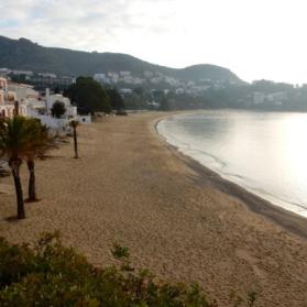
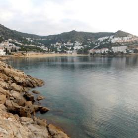
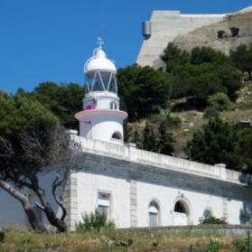
The itinerary starts at the lighthouse of Roses, just below the Trinitat castle, and consists in a practically flat footpath with some stairs. Once we get to Canyelles Petites Beach you can see els Brancs, the small rocky islands from which our gastronomic restaurant takes its name. Continuing along the route and past the beach we will reach our hotel, which has direct access to this lovely route. Finally we will arrive at Almadrava Beach, named after the fishing technique of tuna capture that used to be practiced therein. Almadrava is the last large beach in the south of Cap de Creus before entering the Natural Park and from here we can go back to the point of departure or we can continue all the way to cala Montjoi.
Second section: from Almadrava beach to cala Montjoi
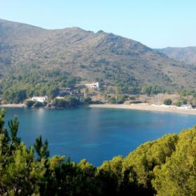
This section involves a bit more difficulty since we will leave behind us the urbanised ground and we will take a narrow dirt path that gets into the Natural Park of Cap de Creus for just over 4 km. It will take us five hours (round trip) to complete this walk that runs between cliffs and typical Mediterranean vegetation of pine forest and scrubland.
One kilometer after starting the footpath in Almadrava Beach we will get to our first stop, punta Falconera (Falcon’s Point), an ancestral habitat of falcons. This enclave, with views to the whole Bay of Roses, was occupied by the Spanish soldiers from 1944 until 1993 due to its strategic location. We can still see a group of five bunkers connected by underground tunnels and secret halls that were part of a defense plan along the Pyrenees created by the govern of the dictator Franco to defend against a possible attack from the allies in the context of the end of World War II. At the beginning of this century the City Council of Roses acquired those lands from the Spanish soldiers and as a result of that every year takes place “l’Aplec de Falconera”, a popular fiesta celebrated in the middle of spring that gathers neighbours from Roses to enjoy this excellent spot. From punta Falconera the path adapts to the ground and the slope increases and decreases gradually. In this section of the footpath we will pass through several coves of clear water, as cala Murtra (nudist) and cala Rostella, and some others of more difficult access but very appealing to divers and swimmers. Once we reach cala Montjoi we will have to go back to the point of origin.
The most courageous can continue until Cadaqués, a trip of 20 km length (one way) from the lighthouse of Roses and that can be completed in about seven hours.
Coastal Path 2 (Almadrava-Cala Montjoi)
Coastal Path 1 (Roses Lighthouse-Almadrava)


